


What is La Niña?
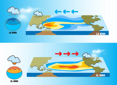
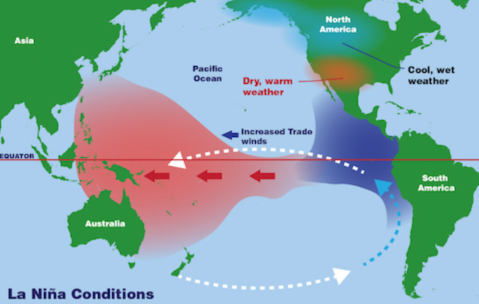
La Niña is a phase of the El Niño Southern Oscillation (ENSO), where the Pacific Ocean between Indonesia and South America is cooler than usual.
It causes normal or above-normal rainfall in India during monsoons and droughts in Africa.
La Niña events can intensify hurricanes in the Atlantic and create harsh winters in India.
La Niña's counterpart, El Niño, brings extreme summers and droughts in India, with increased rainfall in the southern U.S.
Climate change may increase the frequency and intensity of La Niña and El Niño events.
Will a La Niña emerge this winter?
La Niña has not formed as expected in 2024; historically, it forms during monsoon or pre-monsoon, but only twice since 1950 has it formed between October and December.
There is only a 57% chance of La Niña forming in 2024.
The Oceanic Niño Index (ONI) currently stands at -0.3°C, which is close but not enough to confirm a full La Niña.
What is the meteorology?
Southern India cities like Bengaluru and Hyderabad are experiencing colder winters, while northern India faces a delayed winter with above-normal temperatures.
La Niña winters generally feature colder nights but higher daytime temperatures.
Wind speed is higher during La Niña winters, helping reduce air pollution by dispersing pollutants, but a lower planetary boundary layer height could trap pollutants near the ground, potentially worsening air quality.
What about La Niña and monsoons?
La Niña tends to bring robust monsoons, as seen in 2020, 2021, and 2022 with normal or above-normal rainfall in India.
El Niño years usually cause below-average rainfall in India, as seen in 2023.
If La Niña persists into the summer of 2025, it could provide relief from heatwaves and positively affect rainfall during the monsoon season.


COMMENTS