


This news summary highlights the devastating landslides that occurred in Wayanad, Kerala, in July 2024, and the subsequent study published in Nature Natural Hazards.
Key takeaways:
The Study:
Investigated the behavior of rapid debris flows during the Wayanad landslides.
Utilized advanced modeling techniques (RAMMS) to track debris flow paths, speed, and impact.
Emphasized the need for improved disaster management strategies, including:
Vulnerability Mapping: Identifying high-risk zones to prevent development in low-lying areas.
Early Warning Systems: Establishing rainfall and soil moisture monitoring stations to trigger timely evacuations.
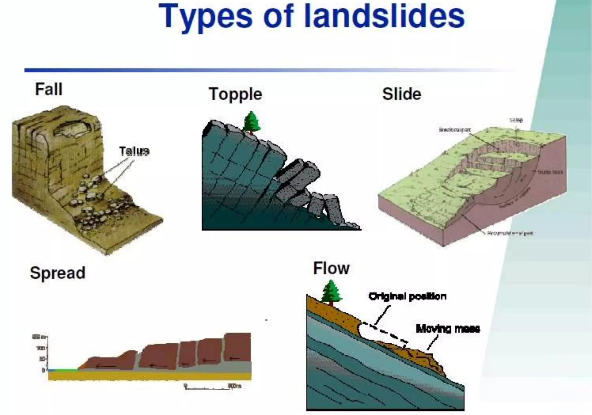
Landslides:
Defined as the downward movement of rock, soil, and debris on a slope.
Triggered by factors like heavy rainfall, earthquakes, human activities, and geological conditions.
Different types include slides, flows, spreads, topples, and falls.
Causes of Landslides:
Natural Factors: Heavy rainfall, earthquakes, and hydrological factors.
Anthropogenic Factors: Deforestation, mining, construction, and urban development.
Wayanad's Vulnerability:
The Western Ghats' steep terrain and high rainfall make it susceptible to landslides.
This study serves as a crucial reminder of the importance of understanding landslide dynamics and implementing effective disaster management strategies to mitigate the risks and minimize loss of life and property in vulnerable areas.


COMMENTS